Access to the Mountain and Parking
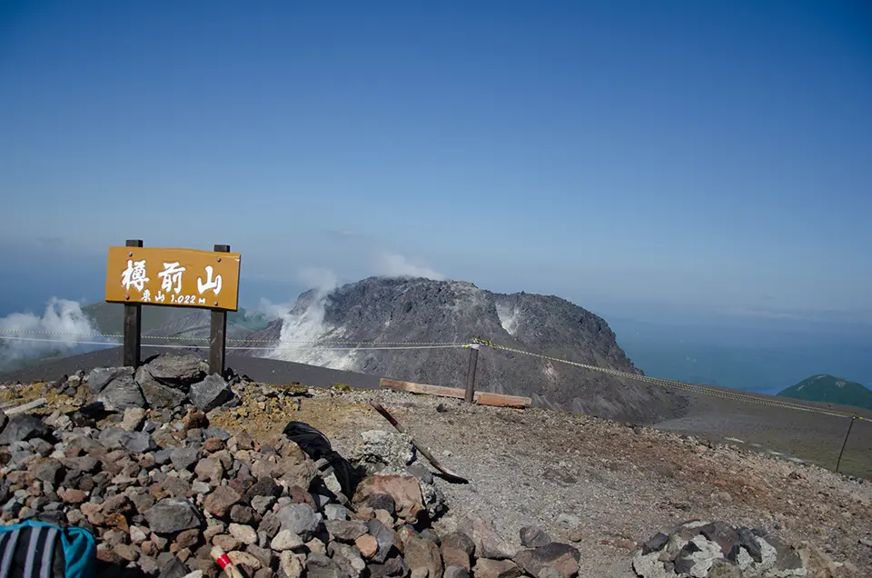
On the south side of Lake Shikotsu stands Mount Fuppushi, which protrudes into the lake. Further south is Mount Tarumae. Mount Tarumae reaches an elevation of 1,041 meters at its highest lava dome and 1,022 meters at Tarumae East Peak, making it slightly taller than Mount Teine in Sapporo.
You can drive up to the 7th station of Mount Tarumae, so the ascent is not very steep, making it a popular destination for people of all ages, from young children to the elderly.
As a result, the parking lot tends to be very crowded on weekends. While the exact time may vary depending on the weather, it is generally recommended to arrive by around 9 AM to secure a parking spot smoothly. On particularly good days for hiking, the parking lot might already be full by that time. If this happens, there will likely be guides directing you to park along the roadside, so please follow their instructions.
To reach the parking lot, take Route 453 running along the south side of Lake Shikotsu and then turn onto Prefectural Route 141 heading south. Along this route, you will make a sharp left turn onto a narrow forest road. During peak times, you may find cars parked as far back as this turn. Such is the popularity of Mount Tarumae!
The parking lot has restrooms, so be sure to use them before starting your climb. Since there are no restrooms along the trail, it is advisable to carry a portable toilet, which can be purchased for about 500 yen at drugstores like Satsudora or convenience stores.
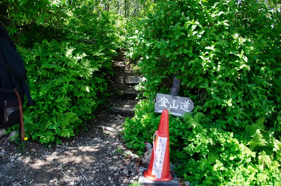
From the Parking Lot to the Summit
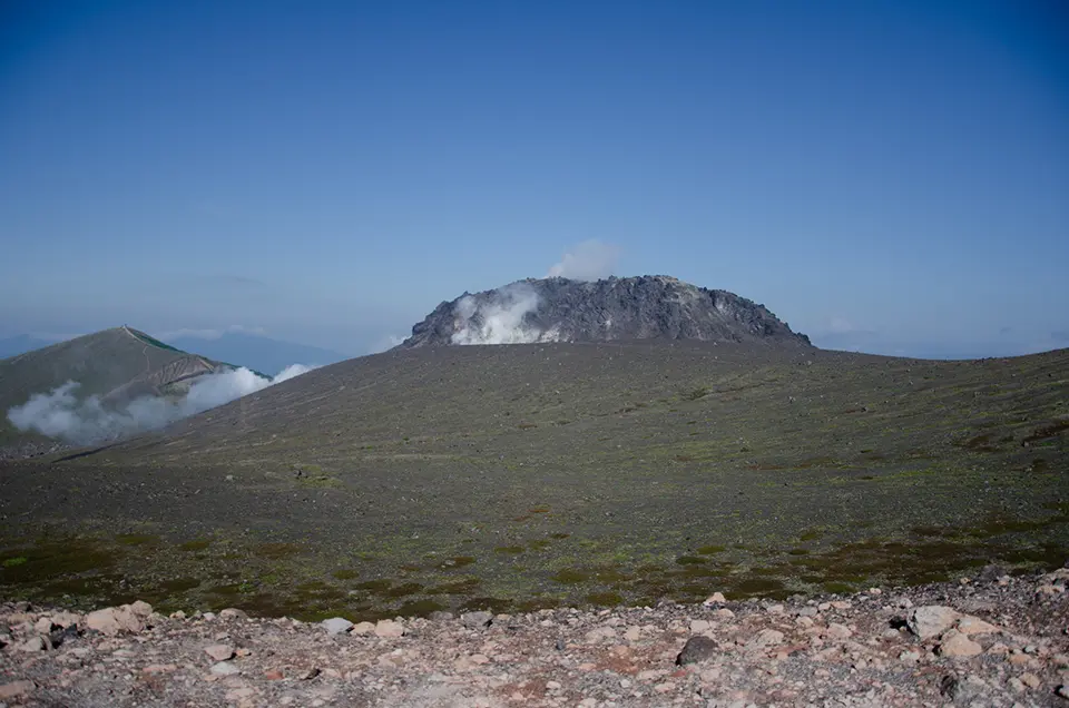
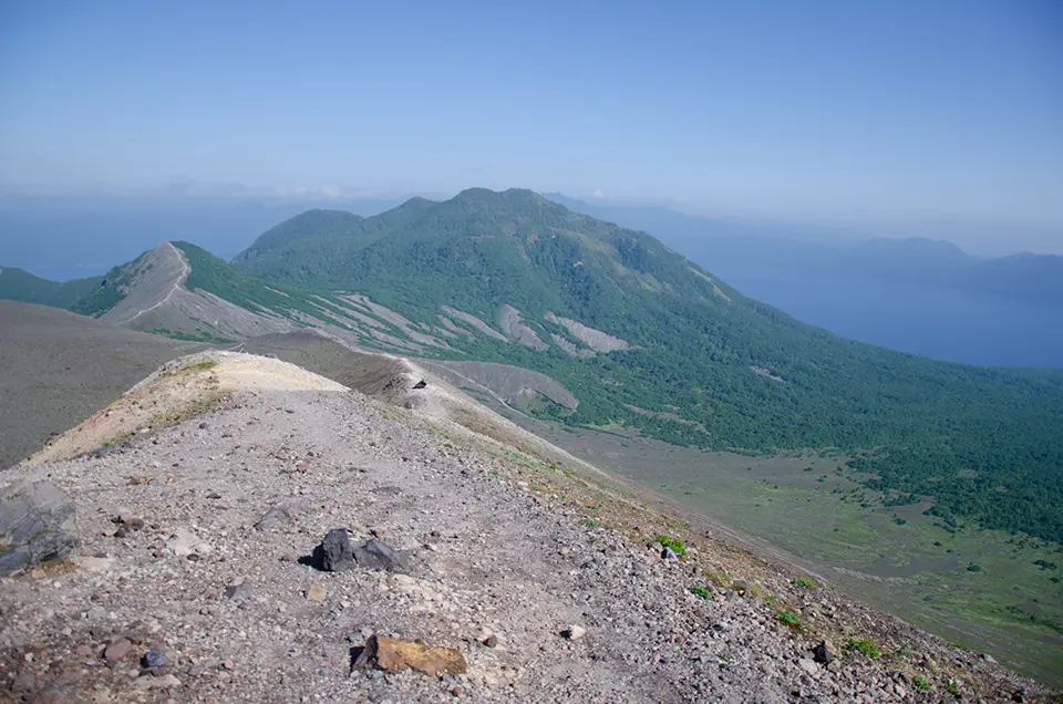
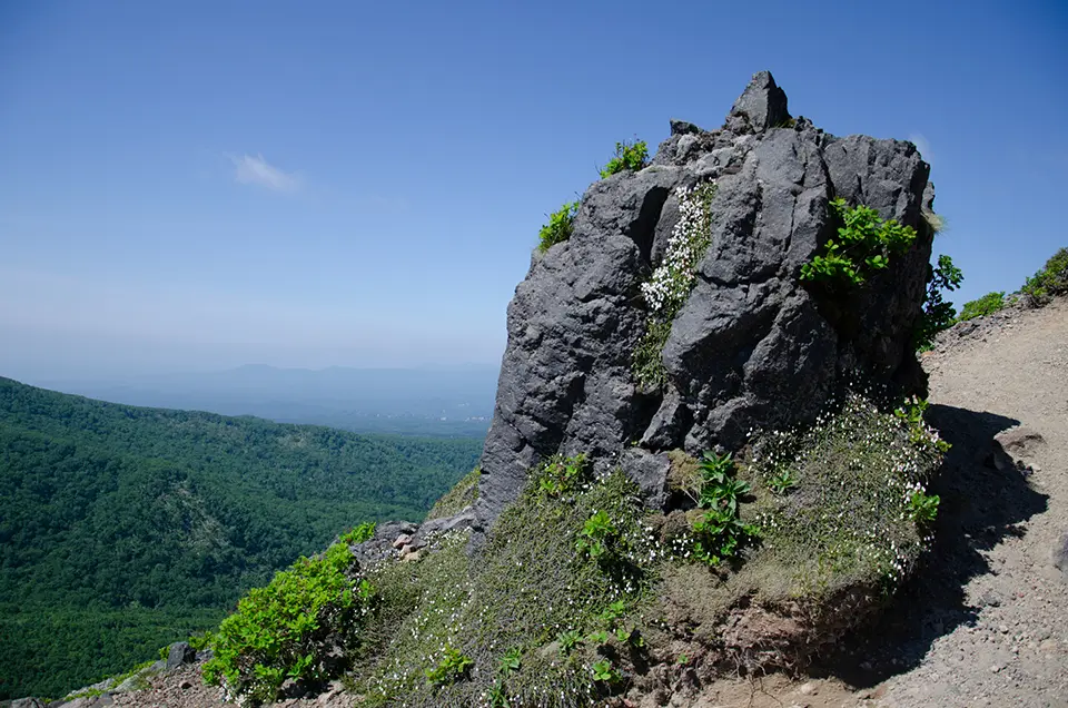
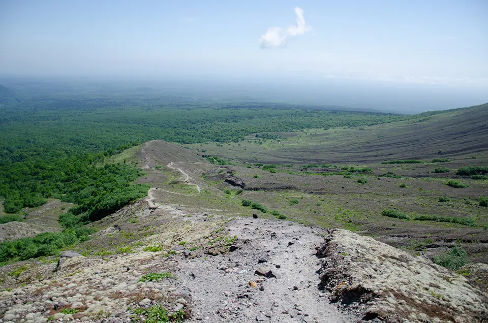
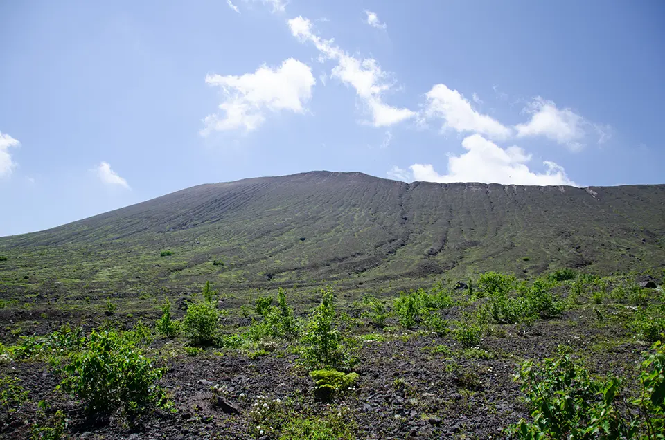
If the sky is clear, you should see the slope of the mountain to the south. Mount Tarumae is an active volcano, with steam rising from its lava dome. Along with Mount Eniwa to the north and Mount Fuppushi next to it, these three mountains surrounding Lake Shikotsu are collectively known as the Shikotsu Three Mountains and are part of Shikotsu-Toya National Park.
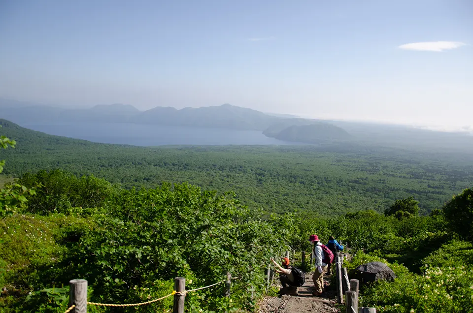
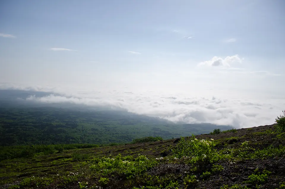
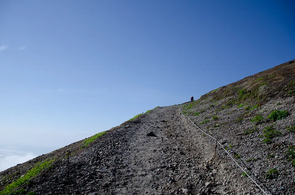
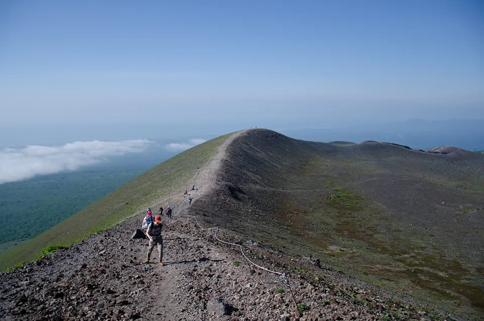
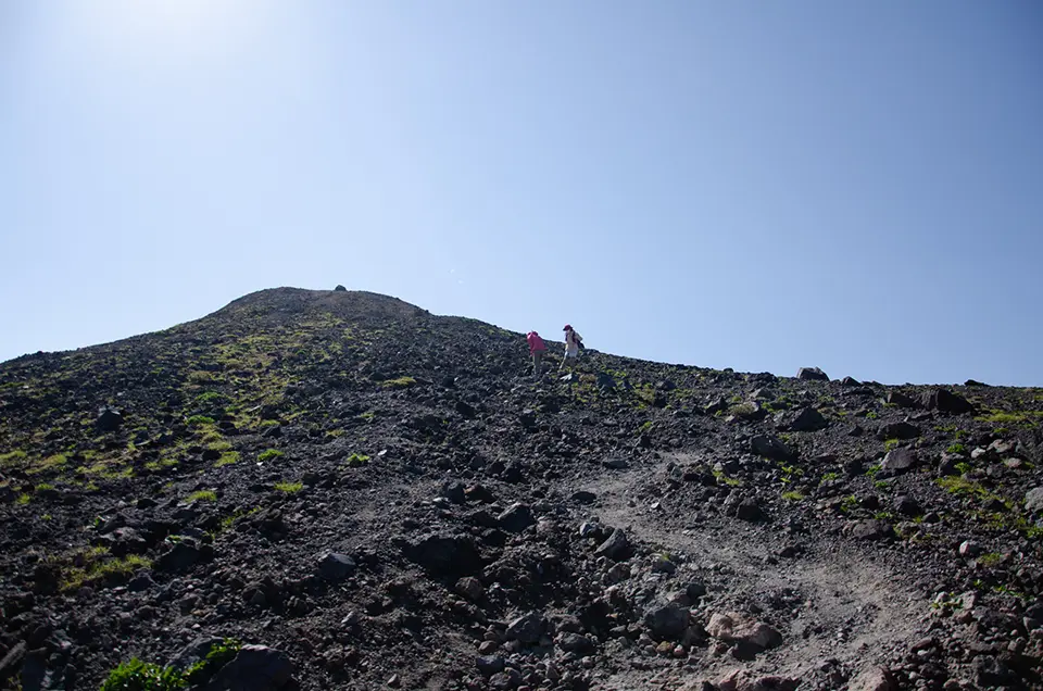
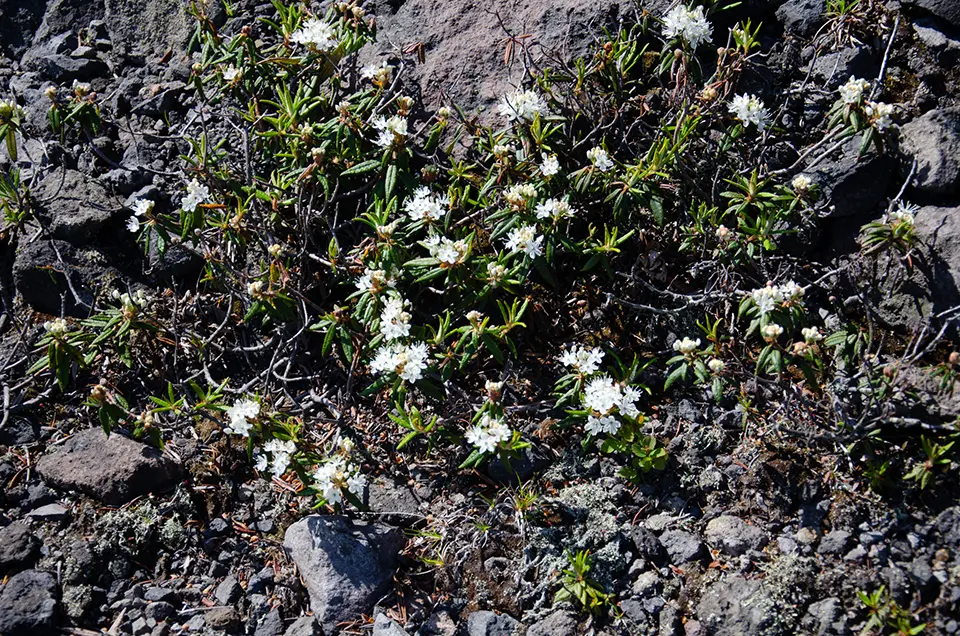
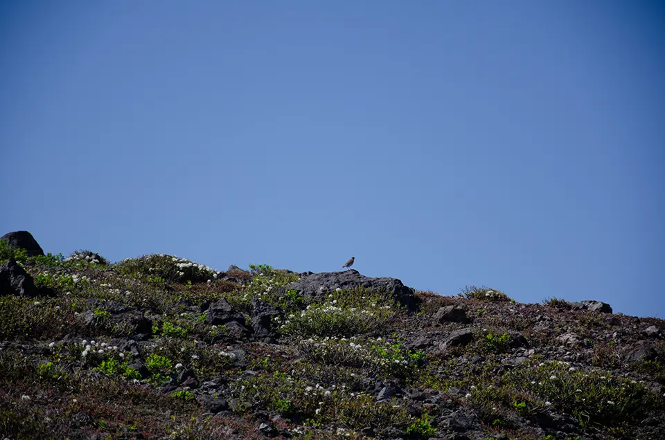
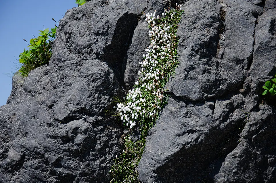
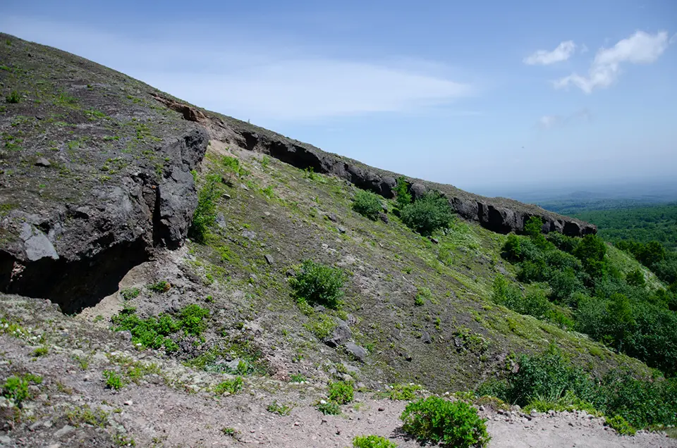
After passing through the forest at the beginning of the hike, the bare slopes of Mount Tarumae come into view. From the 7th station onwards, there are no tall trees, and you climb the exposed, brown slopes, which can be slippery. It is recommended to wear shoes with non-slip soles rather than flat-soled sneakers. The trail continues around the southern side of the mountain. On a clear day, you can see the cityscape of Tomakomai to the left and even the Pacific Ocean beyond. Low alpine plants cling to the slopes, indicating the strong winds typical of the area.
Even if it is not windy in the parking lot, the wind tends to pick up as you ascend. Some slopes can feel particularly harsh due to winds coming from Lake Shikotsu. However, as you walk along the southern slopes, you will find areas sheltered from the wind, which are good spots for lunch. Be cautious at the summit, where the wind is strong, to prevent items like plastic bags from being blown away.
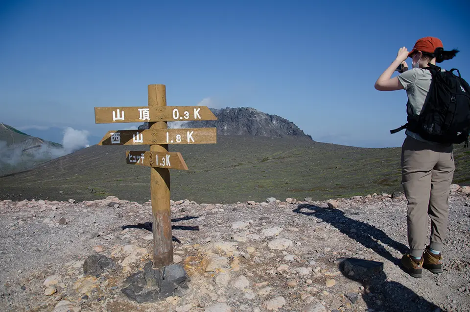
Walking Around the Lava Dome
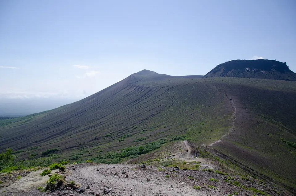
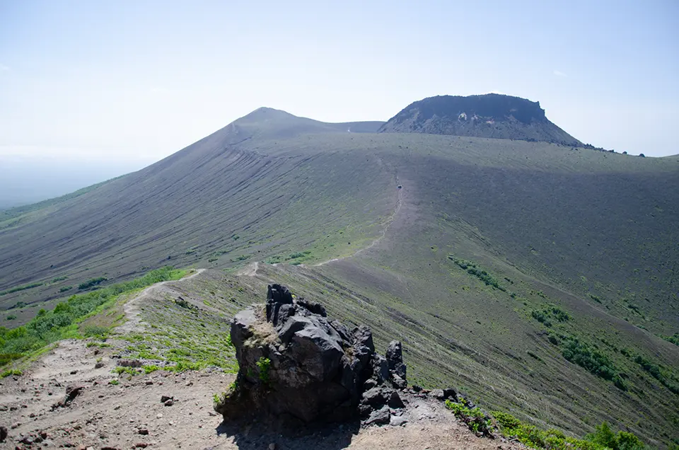
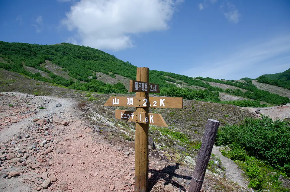
Depending on the weather, it should take about 40-50 minutes to reach the summit, where you first arrive at the 1,022-meter peak of Tarumae East. The trail continues around the lava dome at the summit, giving the impression that the dome has emerged from within the crater. Further south from East Peak is the Tarumae Shrine Okumiya.
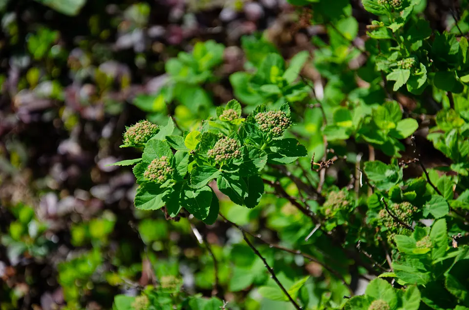
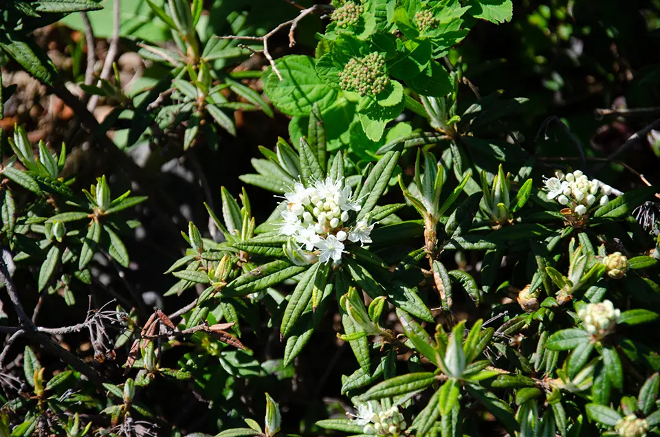
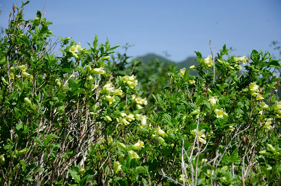
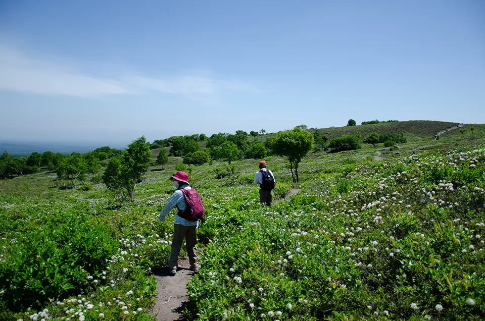
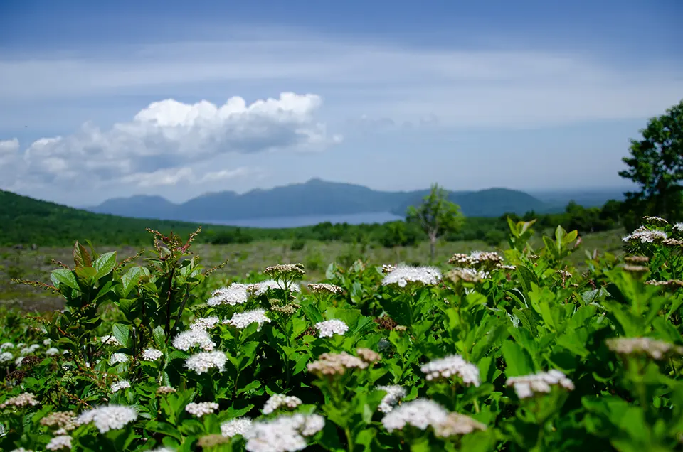
Heading straight from East Peak towards Mount Fuppushi, you get a closer view of the constantly steaming lava dome, reminding you of the volcano’s active status. You can also see Lake Shikotsu peeking from behind Mount Fuppushi. Although it is possible to continue towards Mount Fuppushi from here, on this day, the hike was limited to the area just before it. Enjoying the alpine plants blooming on the slopes, the descent on the north side of Mount Tarumae brings you to gentle slopes covered with flower fields.
This route can be comfortably completed in about two hours, even at a leisurely pace.
Items and Clothing Tips
Even in summer, the top of the mountain can be windy and cold, so be sure to bring windproof outdoor outerwear. Mountain weather can change rapidly, so it’s not advisable to go lightly dressed just because it’s sunny at the trailhead. When you sweat, adjust your body temperature by removing layers as needed. Therefore, choose a backpack with enough room to pack extra clothing. As mentioned earlier, wear sturdy hiking boots to prevent slipping, as the upper parts of the mountain are often slippery.
While the circuit takes about 2 hours, it’s essential to bring at least 1 liter of water, ideally in two 500ml bottles. Sweating can cause salt loss and dehydration, leading to sudden heatstroke, so make sure to hydrate and replenish salt frequently. You can find salt replenishment drops at drugstores or convenience stores, so it’s good to have them on hand.
Access
- 1 hour 30 min from Sapporo by car
- 1 hour from Chitose by car
After hiking
let’s head to the hot springs near Lake Shikotsu. There are hotels with private baths available.
Hotels with private baths:
– Shikotsuko Daiichi Hotel Suizantei
– Shikotsuko Tsuruga Resort Spa Mizu no Uta
Related Articles
Enjoy Hiking Mt.Ichankoppe near Lake Shikotsuko in Winter and Summer
Access
Address
Morappu, Chitose City, Hokkaido 066-0283, Japan